Hike & Go Seek – Copper Harbor

Aerial view of Copper Harbor

Looking for some of the funest and most scenic trails around Michigan. Copper Harbor is your spot. It is an all-season resort town in northeastern Keweenaw County, Michigan located on the Keweenaw Peninsula which juts out from the Upper Peninsula of Michigan into Lake Superior. Due to its natural environment and surroundings it is a popular tourist destination within the Great Lakes region.

One popular spot for visitors is Hunter’s Island which is the name of a non-hilly point running out from the west into Lake Superior.  It was named for an early settler of the area named Mr. Hunter who owned a tract of land on what is now Hunter’s Point or Hunter’s Island.   Situated at the opening of the harbor itself is the historic Copper Harbor Lighthouse built in 1866, replacing an earlier lighthouse made in 1849.  It is only accessible via a short ride in a compact open vessel from the Copper Harbor marina.  Exhibits inside the lighthouse museum cover both the lighthouse history along with the local shipwreck culture of the area.

Copper Harbor is located in Michigan

 Another popular site known as “the most beautiful road in Michigan” is the Brockway Mountain Drive that is an 8.8 mile route that follows the backbone of a 753-foot-high ridge between the towns of Copper Harbor and Eagle Harbor and is the highest paved road between the Rocky Mountains to the west and the Allegheny Mountains to the east.  Constructed during the 30’s, this very picturesque road offers stunning views of Lake Superior and Keweenaw Penisula as well as the archipelago of Isle Royale. (wiki)

B07DX15S4Y

Snow shoes

AMAZON MUSIC – LISTEN FREE

February Winter FUN in the Midwest, USA

Don’t let a snowy forecast stop you from setting aside time for a enjoying the great outdoors.  Head to the woods for a peaceful hike, snow shoeing or cross country skiing.

Turkey Run State Park, Indiana

For picturesque views!

download

You’ll marvel at the natural geologic wonders of this beautiful park as you hike along its famous trails. Nestled along State Road 47 southwest of Crawfordsville, the park offers the chance to explore deep, sandstone ravines, walk along stands of aged forests, and enjoy the scenic views along Sugar Creek.

Door County, Wisconsin

Sightseeing along frozen Lake Michigan

download (2)

Many people call Door County the Cape Cod of the Midwest, and that’s no less true in winter, when snow covers the picturesque northeast Wisconsin peninsula. Shops, galleries and inns stay open for visitors who come for cozy shopping and peaceful walks along frozen Lake Michigan beaches. Sleigh rides, trolley tours and wine tastings round out a romantic weekend.

Interstate State Park, Wisconsin and Minnesota

Hardy hikers can snowshoe on fresh white snow

5CF53E53-1DD8-B71B-0BC4DE60DE73ADF6

Interstate Park comprises two adjacent state parks on the Minnesota-Wisconsin border, both names Interstate State Park.  The staddle the Dalles of the beautiful St. Croix River, a deep basalt gorge with glacial potholes and other rock formations.

Southwest Lake Michigan shore

A stunning winter lighthouse road trip landscape!

images

Every winter, lake-effect storms leave southwest Michigan’s lighthouses and sand dunes cloaked in ice and snow.  From South Haven to New Buffalo and beyond winter is the perfect time to  take a road trip  along Lake Michigan, especially since the beautiful scenes of winter are in full force now.

KEEP WARM THIS WINTER – ALL HATS AND SCARVES – 27% OFF

KEEP WARM THIS WINTER – ALL HATS AND SCARVES – 27% OFF

B07SVNZXY4

PARKS

B0881ZDLJ3

TREKKING THE WORLD

B07Z86ZHHJ

NATIONAL PARKS TRIVIA

B08L5RBR3J

NATIONAL PARK ADVENTURE GAME

B000809OAO

TICKET TO RIDE – EUROPE

Hike & Go Seek – Indiana Dunes in January

Man Looking at Snow Covered Trees

Love sand and hiking on snow packed sandy paths. Indiana Dunes National Park, designated as the nation’s 61st national park is located in Northwestern Indiana along the southern shores of Lake Michigan.  Hiking, cross-country skiing and snowshoeing are popular in the wintertime. You might want to consider snowshoes.

Photo of a Person Pouring Coffee in the Mug

In spring and summer, the park runs for nearly 25 miles alongside of Lake Michigan containing approximately 15,000 acres where you will find sand dunes, wetland, river, prairie and forest ecosystems.  The Park is host to a wide variety of wildlife including white-tailed deer, red fox, raccoons, opossums, cottontail rabbits, various rodents, Canada geese, gulls, squirrels, hawks, turkey vultures , mallards, great blue herons, songbirds and garter snakes.   There are nine different diverse trails to explore!       *  Paul H. Douglas Trail     *  Tolleston Dune Trail     *  Succession Trail.     *  Bailly-Chellberg Trail.     *  Little Calumet River Trail.     *  Cowles Bog Trail.     *  Calumet Dune Trail     *  Glenwood Dune Horse and Hiking Trail   The Indiana Dunes has over 369 species of flowering plants of which thirteen are considered threatened or in danger of extinction.  In addition, there are four invasive flowering plants on the list.  Some of the more common spring flowers you will find include the May apple, 6 varieties of buttercups, and violets.

During the Summer months orchids and lots of goldenrods can be found.   For your first visit to the park, it is highly recommended that you visit the Dorothy Buell Memorial Visitor Center located at U.S. Route 20 and Indiana Route 49 near Porter, Indiana.  The center offers standard visitor-center amenities including a video, brochures, hands-on exhibits and a gift shop.  It is free to the general public.   If you like to camp…..check out the Dunewood Campground located on U.S. Route 12 which includes two loops of trailer accessible sites and a RV dump station.  All sites have grills, a picnic table and access to restrooms with running water and showers.  There are also a limited number of camp sites at the neighboring Douglas Loop. The park provides for 45 miles of hiking, fishing, swimming, horseback riding and cross-country skiing.  Cycling is available on the Calumet Trail which is a crushed limestone multi-use trail that runs through the eastern section of the park.  With all the things to see and do here……………….the park will draw over 2 million visitors each year.   (wiki)

B07XMM3PCJ

THERMAL SOCKS

B08CR4ZJ2H

60 National Parks, Wilderness Wonder – 1000 Pieces Puzzle

Columbia Waterproof Hiking Shoes

168268265X

America’s Best Day Hikes     

Shop Now

Frozen Waterfalls, Icefalls & Canyons of the Midwest USA

jpeg
jped
jep

Who says you cannot enjoy the Midwest in the Winter. Plan to be surprised and awed at the spectacular natural features found here at Starved Rock in Illinois.

Surrounded by the flat, seemingly endless fields of Illinois farm country, a totally different topography is found within the park. Starved Rock was formed thousands of years ago by the melting of glaciers releasing torrents of water. As the water rushed downstream it eroded and stripped away everything in its path except the resistant St. Peter sandstone. It is that sandstone that formed the steep rock walls and the cool dark valleys of the eighteen canyons. When conditions are right cascades of falling water spill down into these gorges, creating the waterfalls so many come here to enjoy.

WATERFALLS
Although you can technically see waterfalls in 14 of the 18 canyons, some of the most scenic waterfalls are found in St. Louis, French, Wildcat, Tonty, Ottawa and Kaskaskia canyons. The best times to see waterfalls are in the spring when the snow and ice melt or after a heavy rainfall.

KEEP WARM THIS WINTER – ALL HATS AND SCARVES – 27% OFF

ICEFALLS
Winter brings a whole new life to the canyons. The freezing and melting that happens during this time of year creates amazing ice sculptures in the canyons. Make sure you come back in the winter to see an icefall – they are spectacular!

600 million years ago Northern Illinois was part of a broad upland that was undergoing extensive erosion. The erosion wore
the land down to near sea level. Erosion that forms a near sea
level surface is called a peneplain. This peneplain was submerged several times by sea water and several layers of sediment were laid on the surface.
Starved Rock State Park was once covered with 3000-5000
feet of glacial ice on and off over a course of 700,000 years.
Glacial ice can move forwards never backwards. When a glacier is said to be retreating, it is actually melting faster than it is
moving forward. As glacial ice can only move forward, it picks
up rocks and carries them in the ice. When the ice melts, these
rock particles are dropped at the point of melting. All dropped
rock material is called drift. Drift found at the point of melting is
called till. Till is unsorted glacial drift. When the glacier is stagnant, the drift accumulates into a pile called an end moraine.
After the glacier has retreated, it leaves a range of irregular hills
which are the end moraine. The melt waters of the glacier were
so great that they would accumulate behind the moraines and
form vast lakes. The streams that drain these lakes were gigantic compared to today’s streams. The Illinois Valley was
formed by one of these streams.
15,000 years ago during the Wisconsinan Glacial Age, the glacial meltwater of a large lake overtopped the Marseilles Moraine and formed Lake Ottawa behind the Farm Ridge Moraine
that ran north to south along what we call Starved Rock State
Park today. This lake drained when it overtopped the Farm
Ridge Moraine cutting a channel that became the Illinois River.
Repeated meltwater floods of the Kankakee Torrent poured
through the channels cut through the Marseilles and Farm
Ridge Moraines establishing the drainage for the Illinois, Fox,
and Vermillion Rivers. This repeated drainage also cut the outcrops , overlooks, and 18 canyons that you see today.

B07SVNZXY4

PARKS

B007MIWUG0

READ FOR FREE

0996962662

Whispers in the Wilderness

B005CRQ4XI

Wild: From Lost to Found

1732352224

Nature’s Silent Message 

Winter Hiking – The Blue Water River Walk – Michigan, USA

As snow and ice cover hiking trails in wintertime, sometimes a hike along a river walk so long as it’s not too winter, is an ideal option.

The Blue Water River Walk is a one mile stretch of land that runs along the St. Clair River in Port Huron, Michigan.  It has it’s own unique naturalized shoreline that is made up from natural rocks, pebbles and boulders while also consisting of many native plants, flowers, trees and shrubs that grow in their own natural landscape and habitat onshore.  The River Walk provides for a place where the natural habitat can thrive and visitors can take a walk along the shoreline and enjoy looking for turtles, watch the freighters or enjoy a nice outdoor picnic.

The River Walk provides for a place where the natural habitat can thrive and visitors can take a walk along the shoreline and enjoy looking for turtles, watch the freighters or enjoy a nice outdoor picnic.

Pedestrian Trial


A very unique and noticeably different feature of the new St. Clair river shoreline along the Blue Water River Walk is the huge boulder and stone structures sticking up from the water just offshore.  These are huge offshore reefs that extend downwards almost 15 feet into the river bottom.  These large boulders weigh as much as 4,000 pounds and are resting on two other layers…recycled slabs of cement on the very bottom and a middle layer of smaller boulders.  All together over 8,000 tons of rock, stone, cement and boulders were used to build these reefs.


Perhaps the most striking different aspect of the new St. Clair River shoreline along the Blue Water River Walk is the huge stone and boulder structures sticking up from the water just offshore. These huge offshore reefs extend down almost 15 feet into the river bottom. The large boulders seen on the surface weigh as much as 4,000 pounds. They are resting on two other layers; recycled slabs of cement on the very bottom and a middle layer of smaller boulders. All together, over 8,000 tons of rock, stone, cement and boulders were used to build these reefs.

These offshore reefs are a critical element to the overall naturalization of the St. Clair River shoreline.  The reefs are there to serve two purposes:  first, they help to knock down the incredibly strong wave energy caused by passing boats and if left unchecked those waves can create serious damage and erosion to the new shoreline.  Secondly, they create new shallow water habitats between the reefs and the shoreline which is critical to the growth and development of small fish, reptiles and amphibians.  

VIEW ALL SALE ITEMS ON ESTY

VIEW ALL SALE ITEMS ON ESTY

Hike & Go Seek – The Ice Age Trail of the Midwest

Looking for premier hiking in the Midwest.  Look no furture….The Ice Age Trail is a National Scenic Trail located in Wisconsin. The trail is also one of 42 designated Wisconsin state trails and the only one specifically designated as a “State Scenic Trail.” From Interstate State Park on the Minnesota border to Potawatomi State Park on Lake Michigan, the Ice Age Trail winds for more than 1,000 miles, following the edge of the last continental glacier in Wisconsin.

One of only 11 National Scenic Trails, the Ice Age Trail is intended to be a premier hiking trail and conservation resource for silent sport and outdoor enthusiasts. The trail traverses some of Wisconsin’s most scenic landscapes and helps tell the story of the last Ice Age by highlighting Wisconsin’s unique glacial features.

Primary attractions include topography left by glaciation in the Last Ice Age. Glacial features along the trail include kettles, potholes, eskers, and glacial erratics. Many of the best examples of glacial features in Wisconsin are exhibited in units of the Ice Age National Scientific Reserve, most of which lie along the trail.

This image has an empty alt attribute; its file name is 220px-IATMonches.JPG

The Ice Age Trail is primarily an off-road hiking and backpacking trail that provides excellent opportunities for sightseeing, wildlife viewing and bird watching. In winter, some sections of the trail are open for cross-country skiing and snowshoeing.

The Ice Age Trail includes parts of other Wisconsin state trails.

  • Gandy Dancer, St. Croix Falls to Frederic
  • Tuscobia, Rice Lake to Birchwood
  • Mountain-Bay, near Hatley
  • Military Ridge, near Verona
  • Badger, near Fitchburg
  • Sugar River, Monticello to Albany
  • Glacial Drumlin, near Wales
  • Eisenbahn, near Kewaskum
  • Ahnapee, Casco Junction to Sturgeon Bay

1732352224

Nature’s Silent Message 


ETSY – ALL HATS & SCARVES ON SALE

Unforgettable Winter Destinations

WINTER COMPLETELY CHANGES THE LANDSCAPE IN THE MIDWEST, OFFERING MILES AND MILES OF NEW PERSPECTIVE

INDIANA – MCCORMICK’S CREEK STATE PARK EXPLORE THE SPECTACULAR LIMESTONE CANYON, FLOWING CREEK, AND SCENIC WATERFALLS

Post image

IOWA –  DAWN ON THE LANDSCAPE OF THE MISSISSIPPI RIVER AT PIKES PEAK STATE PARK, IOWA

KANSAS – DEEP CREEK WATERFALL AT PILLSBURY CROSSING WILDLIFE AREA

Image result for winter hiking in kansas

MICHIGAN’S UPPER PENNISULA AVERAGES 200 INCHES OF SNOWFALL EACH YEAR AND BOASTS PLENTY OF FROZEN WATERFALLS FOR CLIMBING

MINNESOTA – THE ITASCA STATE PARK IS A BEAUTIFUL PLACE TO EXPLORE IN THE WINTER. MINNESOTA DNR

Image result for hiking in winter in minnesota

MISSOURI – ONONDAGA CAVE STATE PARK – LEASBURG

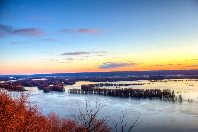
Photo Credit: MHarrisW/TripAdvisor

NEBRASKA – FROZEN WATERFALL ALONG THE STONE CREEK HIKING TRAIL AT PLATTE RIVER STATE PARK

NORTH DAKOTA – THE WINDING TRAIL THROUGH PART OF THE 200 ACRE NATURE PRESERVE IN THIS STATE PARK WILL TAKE YOU THROUGH SOME ABSOLUTELY AMAZING SIGHTS. THERE ARE PLENTY OF PLANTS AND ANIMALS TO BE FOUND HERE

OHIO – OLD MAN’S CAVE LOOP (HOCKING HILLS STATE PARK)

SOUTH DAKOTA – WINTER IN THE BLACKHILLS

Winter, Spearfish Falls

WISCONSIN – LAKE SUPERIOR ICE CAVES

168268265X

America’s Best Day Hikes     

Shop Now

Frozen Waterfalls of Starved Rock

jpeg
jped
jep

Plan to be surprised and awed at the spectacular natural features found here at Starved Rock in Illinois.

Surrounded by the flat, seemingly endless fields of Illinois farm country, a totally different topography is found within the park. Starved Rock was formed thousands of years ago by the melting of glaciers releasing torrents of water. As the water rushed downstream it eroded and stripped away everything in its path except the resistant St. Peter sandstone. It is that sandstone that formed the steep rock walls and the cool dark valleys of the eighteen canyons. When conditions are right cascades of falling water spill down into these gorges, creating the waterfalls so many come here to enjoy.

WATERFALLS
Although you can technically see waterfalls in 14 of the 18 canyons, some of the most scenic waterfalls are found in St. Louis, French, Wildcat, Tonty, Ottawa and Kaskaskia canyons. The best times to see waterfalls are in the spring when the snow and ice melt or after a heavy rainfall.

ICEFALLS
Winter brings a whole new life to the canyons. The freezing and melting that happens during this time of year creates amazing ice sculptures in the canyons. Make sure you come back in the winter to see an icefall – they are spectacular!

KEEP WARM THIS WINTER

30% OFF – View on Etsy